Fort Siloso: Johore Battery Page 5

Johore 15 Inch BL Battery - Page 5
Demolition of the No.3 Emplacement
In 1975, work began to rebuild Changi Air Base into an international airport. This would replace Paya Lebar as Singapore’s International Airport, Paya Lebar not being considered as suitable for expansion for many reasons. Land reclamation and building work would destroy visible remains of the Changi, Beting Kusah, Changi Inner and Changi Outer batteries. In 1978, the No.3 Emplacement of the Johore Battery was demolished. There were now no visible signs of the Johore Battery.
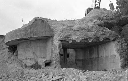
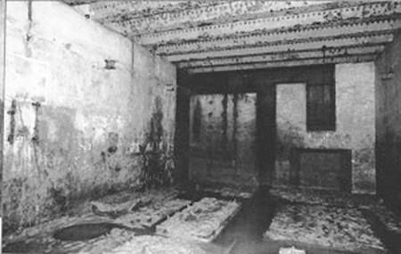
LEFT: The remains of the Shell Store with the Handling Room beyond.
RIGHT: The Burster of the Engine Room. The doorway was the entrance passage to the Engine Room/Magazine complex.
A Burster was a concrete shell surrounding an underground area. As the name implies, the Burster was designed to absorb incoming fire, thus preventing any penetration of the area inside.
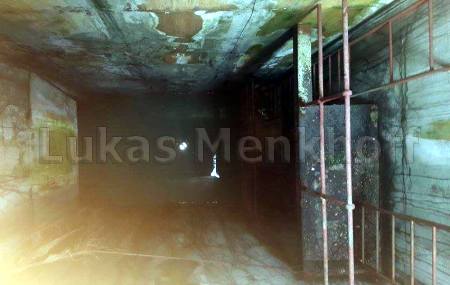
LEFT & RIGHT: The Gun Well with the Handling Room at the bottom.
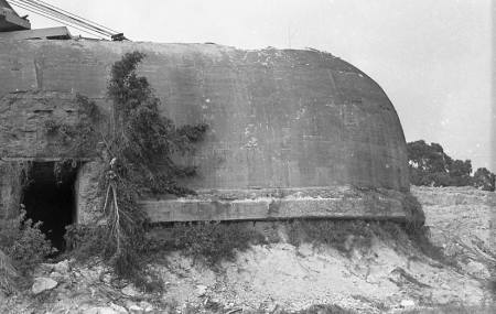
The No.1 Emplacement
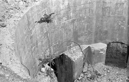
Lloyd Lease, where Abingdon Road and Cosford Road RAF Married Quarters were, was demolished when the Singapore Prisons Service took over the area for an expansion of prison provision. In April 1991, whilst doing some area cleaning work, the No.1 Emplacement of the Johore Battery was partly uncovered. Further clearance was done and an investigation in to what exactly had been uncovered was launched. It was not long before it was realised that the site of the Johore Battery No.1 Gun had been uncovered. The magazine was flooded and was pumped out, explored, and photographed.
LEFT: The No.1 Engine Room.
RIGHT: A flooded entrance shaft to the Magazine.
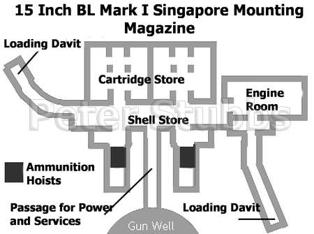
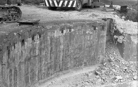
LEFT: A plan of the No.1 Magazine.
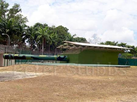
RIGHT: The Replica 15 Inch Gun.
The Magazine was sealed once again, but its outline was created in concrete directly above it on the surface behind the gun well. A replica 15 Inch Gun was manufactured and placed where The No.1 Gun, on its Singapore Mounting once stood.
The new historical site was officially opened on 15th February 2002 as part of a programme commemorating the 60th anniversary of the fall of Singapore. The opening was witnessed by 200 returning POW and their families and friends.
The No.2 Emplacement
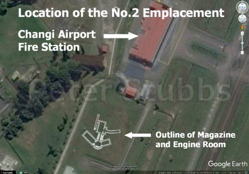 LEFT: Whilst the No.3 Emplacement has been destroyed, and the No.1 Emplacement still has its Magazine and a replica gun, what of the No.2 Emplacement?
The Trunnion Height (swivel point of the barrel) of the No.2 Gun was 50 feet above sea level. The height of the ground there today, is a close match for the ground level of the gun. a comparison of modern and period maps and photographs, seem to indicate that the emplacement has not been demolished. In addition, there is no reference I can find in the press to any demolition work. The demolition of the No.3 Emplacement was well covered in the press.
There is a large ‘hump’ on the ground where the Gun was. In the absence of any evidence to the contrary, there is every reason to believe that the magazine is still there. It would be nice to be able to do a ground survey there and establish if there is anything still there.
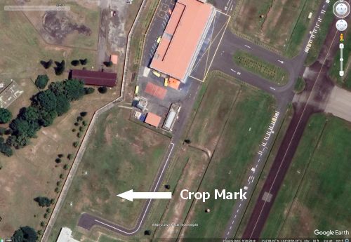 RIGHT: While looking at historical imagery of the location of the No.2 Gun on Google Earth, I noticed something that I thought was quite interesting. In images taken over several years, what seems to be a circular crop mark appears in exactly the same location. The mark shows up better in photos taken during drier periods.
The crop mark aligns almost perfectly with the location that I have plotted for the No.2 Gun in the photo above. The diameter of the crop mark as measured on Google Earth, is also a close match for the diameter of the gun well.
Is this evidence that the No.2 Emplacement lies buried by the airport fire station? I like to think so. Perhaps some day it will be possible to make a survey of the area with ground penetrating radar. Would that provide similar evidence to the survey at Pine Grove where the Buona Vista No.2 Gun once was?
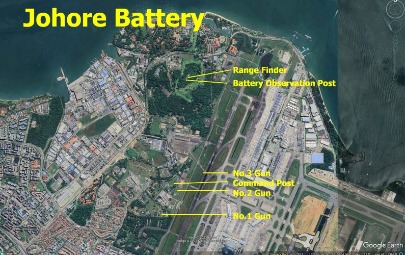
The Johore Battery